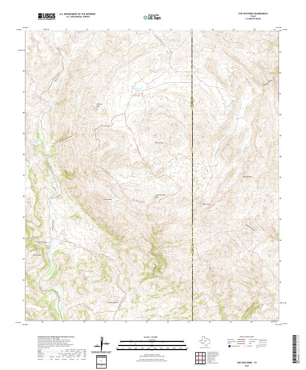
2022 Map of The Solitario
USGS Topo · Published 2022About this map
The Solitario dominates this landscape on the border of Presidio and Brewster counties, revealing a massive geologic circularity that defines the local terrain. Ancient routes and park roads thread through the complex topography, including the Old Stage Road Trl and the Government Road Trl, marking the historical transit corridors used by early settlers and travelers in the Big Bend region. The drainage patterns of Fresno Creek and its associated Fresno Canyon carve through the southwestern portion of the sheet, while specific watering points like McGuirks Tanks and Old Log Spring highlight the critical water sources for livestock and inhabitants in this arid environment. Significant landmarks such as Solitario Peak, Needle Peak, and Chimney Rock serve as high-elevation beacons, illustrating the varied peaks and ranges that characterize this part of West Texas.
Find a feature on this map
29 named features on this map. Tap any name to fly to it.
Don’t see what you’re looking for? This feature index may not catch every label — zoom into the map to look around manually.
Map Details
Editions of this 2022 The Solitario Map
This is the sole edition of this map. No revisions or reprints were ever made.
Other maps of this area

1903 · Terlingua
USGS Topo · 1:125,000

1904 · Terlingua
USGS Topo · 1:125,000

1917 · Agua Fria
USGS Topo · 1:62,500

1917 · Tascotal Mesa
USGS Topo · 1:62,500

1931 · Lajitas
USGS Topo · 1:62,500

1937 · Agua Fria
USGS Topo · 1:62,500

1944 · Tascotal Mesa
USGS Topo · 1:62,500

1959 · Emory Peak
USGS Topo · 1:250,000

1965 · Emory Peak
USGS Topo · 1:250,000

1971 · Yellow Hill
USGS Topo · 1:24,000