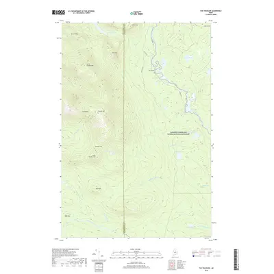
2018 Map of The Traveler
USGS Topo · Published 2018About this map
The Traveler stands as the central massif in this remote portion of the Maine north woods, surrounded by the deep drainages of the East Branch Penobscot River and Wassataquoik Stream. This territory, largely encompassed by the Katahdin Woods and Waters National Monument, reflects a landscape defined by dramatic elevation changes from North Traveler Mtn to South Traveler Mtn. The hydrology of the area is exceptionally complex, featuring numerous remote water bodies like Traveler Pond, Atwood Pond, and Messer Pond, alongside significant river features such as The Oxbow and Grand Falls. A notable human imprint is found at Old City, located near the southern boundary, where the forest begins to reclaim earlier settlement patterns. The map also traces the winding courses of Townline Brook and Pogy Brook, which feed the major waterways that have historically served the region's logging and conservation history.
Find a feature on this map
38 named features on this map. Tap any name to fly to it.
Don’t see what you’re looking for? This feature index may not catch every label — zoom into the map to look around manually.
Map Details
Editions of this 2018 The Traveler Map
This is the sole edition of this map. No revisions or reprints were ever made.
Other maps of this area

1927 · Katahdin
USGS Topo · 1:48,000

1930 · Katahdin
USGS Topo · 1:62,500

1949 · Katahdin
USGS Topo · 1:62,500

1953 · Stacyville
USGS Topo · 1:62,500

1954 · Shin Pond
USGS Topo · 1:62,500

1954 · Presque Isle
USGS Topo · 1:250,000

1954 · Millinocket
USGS Topo · 1:250,000

1955 · Traveler Mountain
USGS Topo · 1:62,500

1958 · Presque Isle
USGS Topo · 1:250,000

1958 · Millinocket
USGS Topo · 1:250,000