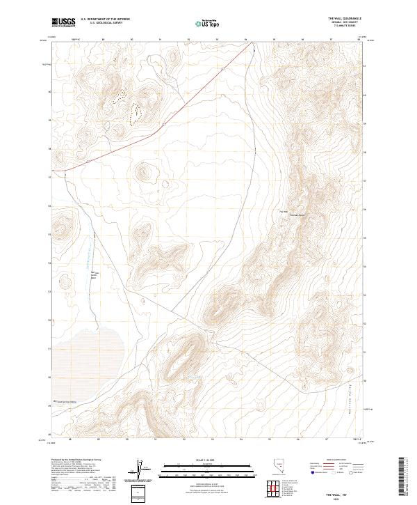
2021 Map of The Wall
USGS Topo · Published 2021About this map
The Wall and the Pancake Range dominate this section of Nye County, where high-desert topography defines the landscape. The map provides a detailed view of the drainage patterns moving between the mountain elevations and the lower flats, notably through the Sand Springs Wash. To the southwest, the terrain opens into the Big Sand Springs Valley, while the eastern edge of the quadrangle marks the descent into the expansive Railroad Valley. A specific point of human-made infrastructure in this arid environment is the Narrows Catch Basin, designed to manage the intermittent water flow characteristic of the Great Basin. This survey illustrates the township and range divisions of the Public Land Survey System, specifically across portions of t7n r53e and t7n r54e, showing how the land was partitioned for management in a region defined by its wide, open valleys and isolated mountain chains.
Find a feature on this map
10 named features on this map. Tap any name to fly to it.
Don’t see what you’re looking for? This feature index may not catch every label — zoom into the map to look around manually.
Map Details
Editions of this 2021 The Wall Map
This is the sole edition of this map. No revisions or reprints were ever made.
Other maps of this area

1956 · Lund
USGS Topo · 1:250,000

1956 · Tonopah
USGS Topo · 1:250,000

1959 · Tonopah
USGS Topo · 1:250,000

1960 · Lund
USGS Topo · 1:250,000

1962 · Tonopah
USGS Topo · 1:250,000

1967 · Lunar Crater
USGS Topo · 1:62,500

1967 · Moores Station
USGS Topo · 1:62,500

1967 · Moores Station SE
USGS Topo · 1:24,000

1967 · Lunar Crater
USGS Topo · 1:24,000
1967 · Chuck Wagon Flat
USGS Topo · 1:24,000