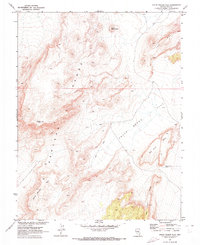
1967 Map of Chuck Wagon Flat
USGS Topo · Published 1973About this map
The Pancake Range dominates the western half of this 1967 survey, providing a detailed look at the basin-and-range topography of Nye County. The landscape is defined by massive formations such as Citadel Mtn and Black Beauty Mesa, which overlook the broad expanse of Chuck Wagon Flat to the east. The geological character of the region is further articulated by the presence of a Big Fault that runs along the eastern edge of the mountains, creating distinct landmarks like Big Fault Ridge and Big Fault Mesa.
Find a feature on this map
11 named features on this map. Tap any name to fly to it.
Don’t see what you’re looking for? This feature index may not catch every label — zoom into the map to look around manually.
Map Details
Editions of this 1967 Chuck Wagon Flat Map
2 editions found
Other maps of this area

1956 · Lund
USGS Topo · 1:250,000

1956 · Tonopah
USGS Topo · 1:250,000

1959 · Tonopah
USGS Topo · 1:250,000

1960 · Lund
USGS Topo · 1:250,000

1962 · Tonopah
USGS Topo · 1:250,000

1967 · Lunar Crater
USGS Topo · 1:62,500

1967 · Buckwheat Rim
USGS Topo · 1:24,000

1967 · Palisade Mesa
USGS Topo · 1:24,000

1967 · Lunar Crater
USGS Topo · 1:24,000
1968 · Reveille
USGS Topo · 1:62,500