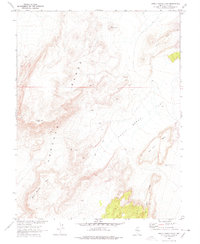
1967 Map of Chuck Wagon Flat
USGS Topo · Published 1978About this map
The Pancake Range dominates this landscape in central Nevada, as surveyed by the Geological Survey in cooperation with the Atomic Energy Commission. This arid, high-altitude terrain is characterized by massive volcanic landforms, including the prominent Citadel Mtn and the broad expanses of Black Beauty Mesa and Big Fault Mesa. The map reveals a remote environment where human presence is minimal, marked primarily by a winding Jeep Trail and a single Water Tank on the eastern edge of Chuck Wagon Flat. Structural geological features are also clearly visible, most notably the towering The Wall in the northeast and the stark Big Fault Ridge. The lack of permanent settlements or significant roads reflects the area's isolation during the late 1960s, serving as a detailed record of the Great Basin's wilderness before later shifts in land use.
Find a feature on this map
11 named features on this map. Tap any name to fly to it.
Don’t see what you’re looking for? This feature index may not catch every label — zoom into the map to look around manually.
Map Details
Editions of this 1967 Chuck Wagon Flat Map
2 editions found
Other maps of this area

1956 · Lund
USGS Topo · 1:250,000

1956 · Tonopah
USGS Topo · 1:250,000

1959 · Tonopah
USGS Topo · 1:250,000

1960 · Lund
USGS Topo · 1:250,000

1962 · Tonopah
USGS Topo · 1:250,000

1967 · Lunar Crater
USGS Topo · 1:62,500

1967 · Buckwheat Rim
USGS Topo · 1:24,000

1967 · Palisade Mesa
USGS Topo · 1:24,000

1967 · Lunar Crater
USGS Topo · 1:24,000
1967 · Chuck Wagon Flat
USGS Topo · 1:24,000