
1967 Map of Buckwheat Rim
USGS Topo · Published 1973About this map
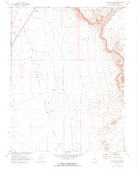
Hot Creek Valley and the eastern slopes of the Pancake Range dominate this 1967 landscape in Nye County. The survey provides a clear view of the structural geology in this part of the Great Basin, highlighting a prominent Monocline and the sheer escarpment of Palisade Mesa above Buckwheat Rim. Human activity is sparse and focused on infrastructure and survival in the arid environment. The Blue Jay Hy Maintenance Sta sits near the northwestern corner, serving the remote road network, while Rays Well and the ephemeral Hot Creek trace the limited water resources available to the region. Traces of industrial use appear as Gravel Pits located on the western edge of the valley, while the heights of Buckskin Pt overlook the expansive desert floor.
Find a feature on this map
11 named features on this map. Tap any name to fly to it.
Don’t see what you’re looking for? This feature index may not catch every label — zoom into the map to look around manually.
Map Details
Editions of this 1967 Buckwheat Rim Map
2 editions found
Other maps of this area

1956 · Tonopah
USGS Topo · 1:250,000

1959 · Tonopah
USGS Topo · 1:250,000

1962 · Tonopah
USGS Topo · 1:250,000

1967 · Lunar Crater
USGS Topo · 1:62,500

1967 · Blue Jay Spring
USGS Topo · 1:24,000

1967 · Palisade Mesa
USGS Topo · 1:24,000

1967 · Lunar Crater
USGS Topo · 1:24,000
1967 · Chuck Wagon Flat
USGS Topo · 1:24,000

1967 · Tybo SE
USGS Topo · 1:24,000

1968 · Tybo
USGS Topo · 1:62,500