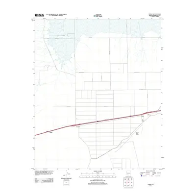
2011 Map of Theba
USGS Topo · Published 2011About this map
Theba and the surrounding agricultural lands of Maricopa County are defined by a strictly organized grid of roads and irrigation infrastructure. The landscape is bisected by a major transportation corridor, where the Theba Interchange and Painted Rock Interchange facilitate movement between the local farming operations and the broader region. This 2011 survey highlights the concentrated settlement patterns at Piedra and the industrial-scale agricultural footprint of the Gila River Ranch, which is supported by its own private aviation facility, the Paloma Ranch Airport. The northern portion of the quadrangle shows a distinct transition in land use, marked by Sisson RD and the drainage patterns leading toward the nearby dam area. The network of local thoroughfares, including Watermelon Rd and S Painted Rock Dam Rd, reflects a landscape engineered for modern high-yield desert farming and transit efficiency.
Find a feature on this map
22 named features on this map. Tap any name to fly to it.
Don’t see what you’re looking for? This feature index may not catch every label — zoom into the map to look around manually.
Map Details
Editions of this 2011 Theba Map
This is the sole edition of this map. No revisions or reprints were ever made.
Other maps of this area

1942 · Vicksburg
USGS Topo · 1:250,000

1949 · Sentinel
USGS Topo · 1:62,500

1950 · Sentinel
USGS Topo · 1:62,500

1950 · Theba
USGS Topo · 1:62,500

1951 · Theba
USGS Topo · 1:62,500

1951 · Dendora Valley
USGS Topo · 1:62,500

1951 · Woolsey Peak
USGS Topo · 1:62,500

1953 · Ajo
USGS Topo · 1:250,000

1954 · Phoenix
USGS Topo · 1:250,000

1957 · Ajo
USGS Topo · 1:250,000