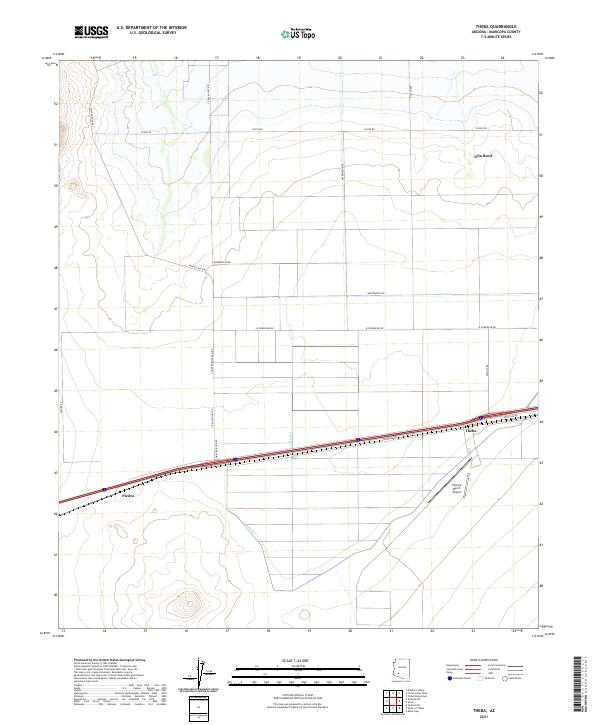
2021 Map of Theba
USGS Topo · Published 2021About this map
Theba and Piedra anchor this modern landscape in the Sonoran desert south of the Gila Bend riverbed. The area is defined by a rigid grid of agricultural infrastructure and road networks that contrast sharply with the natural desert terrain. A complex system of irrigation, including Lateral A, Lateral B, and Lateral D, supports the local farming economy, which is further reflected in descriptive local road names such as Watermelon Rd and Citrus Valley Rd. Transportation and commerce are centered along the Frontage Rd corridor, while the Paloma Ranch Airport provides a specialized aviation link for the surrounding ranchlands. The map reveals the precise intersection of desert resource management and rural Arizona settlement patterns.
Find a feature on this map
21 named features on this map. Tap any name to fly to it.
Don’t see what you’re looking for? This feature index may not catch every label — zoom into the map to look around manually.
Map Details
Editions of this 2021 Theba Map
This is the sole edition of this map. No revisions or reprints were ever made.
Other maps of this area

1942 · Vicksburg
USGS Topo · 1:250,000

1949 · Sentinel
USGS Topo · 1:62,500

1950 · Sentinel
USGS Topo · 1:62,500

1950 · Theba
USGS Topo · 1:62,500

1951 · Theba
USGS Topo · 1:62,500

1951 · Dendora Valley
USGS Topo · 1:62,500

1951 · Woolsey Peak
USGS Topo · 1:62,500

1953 · Ajo
USGS Topo · 1:250,000

1954 · Phoenix
USGS Topo · 1:250,000

1957 · Ajo
USGS Topo · 1:250,000