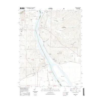
2015 Map of Thebes
USGS Topo · Published 2015About this map
The Mississippi River creates a dramatic boundary between the hills of Illinois and the lowlands of Missouri, centered on the riverfront town of Thebes. This area is defined by the sharp contrast between the dense, forested terrain of the Shawnee National Forest to the east and the agricultural plains near Commerce to the west. Several islands, including Rock Island and Powers Island, navigate the channel, while deep ravines like Black Powder Hollow and Dynamite Hollow reveal the industrial or military history tied to the riverside bluffs. Genealogists will find a high density of burial sites across the landscape, from the Rose Hill Cem in the north to the Thompson Cem near the southern bend. The map also records the small riverside settlements of Fayville and Gale, as well as the transition into the Santa Fe Hills, providing a clear view of the transportation and settlement patterns along this historic reach of the Great River.
Find a feature on this map
90 named features on this map. Tap any name to fly to it.
Don’t see what you’re looking for? This feature index may not catch every label — zoom into the map to look around manually.
Map Details
Editions of this 2015 Thebes Map
This is the sole edition of this map. No revisions or reprints were ever made.
Other maps of this area

1920 · Jonesboro
USGS Topo · 1:62,500

1922 · Cape Girardeau
USGS Topo · 1:62,500

1923 · Jonesboro
USGS Topo · 1:62,500

1924 · Cape Girardeau
USGS Topo · 1:62,500

1934 · Thebes
USGS Topo · 1:62,500

1934 · Morley
USGS Topo · 1:62,500

1939 · Morley
USGS Topo · 1:62,500

1939 · Thebes
USGS Topo · 1:62,500

1947 · Jonesboro
USGS Topo · 1:62,500

1947 · Mc Clure
USGS Topo · 1:24,000