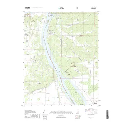
2021 Map of Thebes
USGS Topo · Published 2021About this map
The Mississippi River defines the border between Illinois and Missouri in this 2021 study, serving as a corridor for commerce and a divider for the rugged river bluffs. On the Illinois side, the Shawnee National Forest covers much of the uplands, hiding deep hollows like Joliet Hollow and Black Powder Hollow. Settlements such as Thebes and Fayville sit perched along the eastern bank, while the western Missouri shore features the town of Commerce and the flatlands of Big Cypress.
Find a feature on this map
89 named features on this map. Tap any name to fly to it.
Don’t see what you’re looking for? This feature index may not catch every label — zoom into the map to look around manually.
Map Details
Editions of this 2021 Thebes Map
This is the sole edition of this map. No revisions or reprints were ever made.
Other maps of this area

1920 · Jonesboro
USGS Topo · 1:62,500

1922 · Cape Girardeau
USGS Topo · 1:62,500

1923 · Jonesboro
USGS Topo · 1:62,500

1924 · Cape Girardeau
USGS Topo · 1:62,500

1934 · Thebes
USGS Topo · 1:62,500

1934 · Morley
USGS Topo · 1:62,500

1939 · Morley
USGS Topo · 1:62,500

1939 · Thebes
USGS Topo · 1:62,500

1947 · Jonesboro
USGS Topo · 1:62,500

1947 · Mc Clure
USGS Topo · 1:24,000