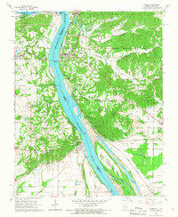
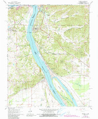
1966 Map of Thebes
USGS Topo · Published 1968About this map
The Mississippi River dominates this mid-1960s landscape, serving as the border between Missouri and Illinois. At the narrowest point of the river channel, the settlement of Thebes sits perched on the eastern bank, while Illmo and Grays Point occupy the Missouri side. This geography created a natural bottleneck that necessitated a complex rail-and-water logistics network, evidenced by the presence of the Missouri Pacific Railroad and the Chicago and Eastern Illinois lines.
Find a feature on this map
79 named features on this map. Tap any name to fly to it.
Don’t see what you’re looking for? This feature index may not catch every label — zoom into the map to look around manually.
Map Details
Editions of this 1966 Thebes Map
2 editions found
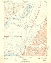
Other maps of this area

1920 · Jonesboro
USGS Topo · 1:62,500

1922 · Cape Girardeau
USGS Topo · 1:62,500

1923 · Jonesboro
USGS Topo · 1:62,500

1924 · Cape Girardeau
USGS Topo · 1:62,500

1934 · Thebes
USGS Topo · 1:62,500

1934 · Morley
USGS Topo · 1:62,500

1939 · Morley
USGS Topo · 1:62,500

1939 · Thebes
USGS Topo · 1:62,500

1947 · Jonesboro
USGS Topo · 1:62,500
1947 · Mc Clure
USGS Topo · 1:24,000