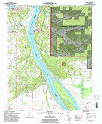
1996 Map of Thebes
USGS Topo · Published 1998About this map
The Mississippi River creates a dynamic border between Alexander County, Illinois, and Scott County, Missouri, in this mid-1990s survey. The river's influence is evident in the complex network of side channels and islands, such as Burnham Island and Goose Island, separated by chutes like Santa Fe Chute and Doolan Chute. On the Illinois side, the riverbank is dominated by the Santa Fe Hills within the Shawnee National Forest, where numerous hollows like Black Powder Hollow and Dynamite Hollow suggest a history of industrial or explosive storage use tucked into the terrain.
Find a feature on this map
64 named features on this map. Tap any name to fly to it.
Don’t see what you’re looking for? This feature index may not catch every label — zoom into the map to look around manually.
Map Details
Editions of this 1996 Thebes Map
This is the sole edition of this map. No revisions or reprints were ever made.
Other maps of this area

1920 · Jonesboro
USGS Topo · 1:62,500

1922 · Cape Girardeau
USGS Topo · 1:62,500

1923 · Jonesboro
USGS Topo · 1:62,500

1924 · Cape Girardeau
USGS Topo · 1:62,500

1934 · Thebes
USGS Topo · 1:62,500

1934 · Morley
USGS Topo · 1:62,500

1939 · Morley
USGS Topo · 1:62,500

1939 · Thebes
USGS Topo · 1:62,500

1947 · Jonesboro
USGS Topo · 1:62,500

1947 · Mc Clure
USGS Topo · 1:24,000