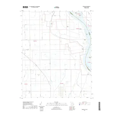
2017 Map of Thebes SW
USGS Topo · Published 2017About this map
The Mississippi River forms a dynamic boundary between Missouri and Illinois in this detailed 2017 study, where the river's shifting hydrology is marked by numerous islands and side channels. Large landforms like Powers Island, Billings Island, and Woods Island are separated from the main channel by features such as Doolan Chute and Billings Slough. This fluvial landscape is mirrored by a complex network of man-made drainage systems on the western plains, including the North-Cut Ditch and Circle Ditch.
Find a feature on this map
61 named features on this map. Tap any name to fly to it.
Don’t see what you’re looking for? This feature index may not catch every label — zoom into the map to look around manually.
Map Details
Editions of this 2017 Thebes SW Map
This is the sole edition of this map. No revisions or reprints were ever made.
Other maps of this area

1931 · Sikeston
USGS Topo · 1:62,500

1934 · Thebes
USGS Topo · 1:62,500

1934 · Morley
USGS Topo · 1:62,500

1934 · Sikeston
USGS Topo · 1:62,500

1939 · Sikeston
USGS Topo · 1:62,500

1939 · Charleston
USGS Topo · 1:62,500

1939 · Morley
USGS Topo · 1:62,500

1939 · Thebes
USGS Topo · 1:62,500

1949 · Paducah
USGS Topo · 1:250,000

1950 · Paducah
USGS Topo · 1:250,000