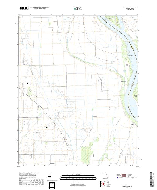
2021 Map of Thebes SW
USGS Topo · Published 2021About this map
The Mississippi River defines the eastern boundary of this Missouri landscape, where the shifting riverbed has created a complex network of bars and secondary channels. Landforms like Goose Island, Anita Towhead, and Billings Island illustrate the river's historical movement, while Doolan Chute and Santa Fe Chute mark former pathways of the main current. This area is heavily managed by an extensive drainage system, including the North Cut Ditch and Brushy Lake Ditch, which converted former wetlands into productive acreage. For researchers, the map preserves the locations of several community burial grounds, such as Prince Cem and Pollard Cem, providing vital clues for family history in this corner of Scott County. The small settlement of Lusk sits near the riverbank, serving as a primary point of reference in an area otherwise characterized by rural farm roads and the legacy of the river's natural meanders.
Find a feature on this map
51 named features on this map. Tap any name to fly to it.
Don’t see what you’re looking for? This feature index may not catch every label — zoom into the map to look around manually.
Map Details
Editions of this 2021 Thebes SW Map
This is the sole edition of this map. No revisions or reprints were ever made.
Historical Maps of Scott County Through Time
5 maps found