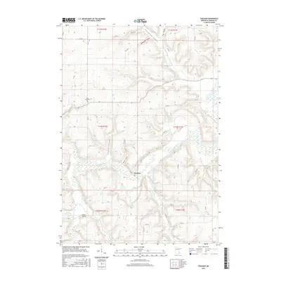
2016 Map of Theilman
USGS Topo · Published 2016About this map
Theilman sits at a low point in the landscape where the Zumbro River and its varied tributaries have carved deep valleys into the surrounding terrain. This part of Wabasha County is defined by its complex drainage network, featuring numerous named coulees such as Cockwood Coulee, Bade Coulee, and Sutton Coulee. These landforms indicate a history of significant water erosion, creating the prominent ridges and bluffs characteristic of the region. Genealogy and local history researchers will find the Scott Settlement Cem on the northern bluffs, providing a connection to the early families who inhabited this portion of the Zumbro Valley. The topography is further punctuated by Foley Mound, while the river is joined by smaller streams like Middle Cr and W Indian Cr. The map details a transition from the agricultural plateaus to the narrow, winding river valleys that supported the small riverside community of Theilman.
Find a feature on this map
52 named features on this map. Tap any name to fly to it.
Don’t see what you’re looking for? This feature index may not catch every label — zoom into the map to look around manually.
Map Details
Editions of this 2016 Theilman Map
This is the sole edition of this map. No revisions or reprints were ever made.
Other maps of this area

1932 · Wabasha
USGS Topo · 1:62,500

1934 · Plainview
USGS Topo · 1:62,500

1935 · Rochester
USGS Topo · 1:48,000

1938 · Plainview
USGS Topo · 1:62,500

1939 · Rochester
USGS Topo · 1:62,500

1951 · Wabasha
USGS Topo · 1:62,500

1951 · Lake City
USGS Topo · 1:62,500

1953 · Saint Paul
USGS Topo · 1:250,000

1959 · Saint Paul
USGS Topo · 1:250,000
1972 · Plainview
USGS Topo · 1:24,000