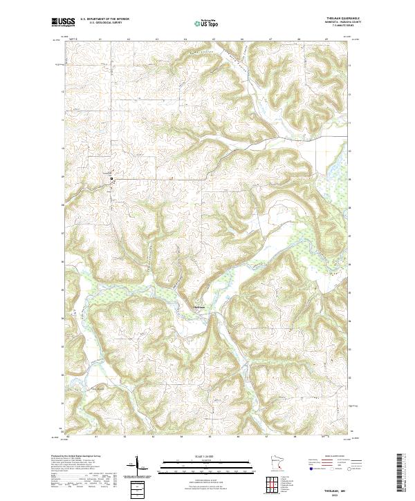
2022 Map of Theilman
USGS Topo · Published 2022About this map
Theilman sits at the convergence of rugged driftless terrain and a complex network of waterways in Wabasha County. The settlement is positioned along the Zumbro River, which is fed by numerous spring-fed tributaries and deep ravines, locally known as coulees. Notable features such as Bade Coulee, Cockwood Coulee, and Rattler Coulee illustrate the deeply dissected landscape of the area. For those interested in local history and genealogy, the Scott Settlement Cem provides a direct link to the early pioneers of the region. The map also records distinctive landmarks like Foley Mound and a series of rural routes including Co Rd 86 and Co Rd 33. The intricate drainage pattern, defined by Indian Cr, W Indian Cr, and the Zumbro River Trail, reveals how the physical geography has historically dictated the placement of roads and homesteads.
Find a feature on this map
33 named features on this map. Tap any name to fly to it.
Don’t see what you’re looking for? This feature index may not catch every label — zoom into the map to look around manually.
Map Details
Editions of this 2022 Theilman Map
This is the sole edition of this map. No revisions or reprints were ever made.
Other maps of this area

1932 · Wabasha
USGS Topo · 1:62,500

1934 · Plainview
USGS Topo · 1:62,500

1935 · Rochester
USGS Topo · 1:48,000

1938 · Plainview
USGS Topo · 1:62,500

1939 · Rochester
USGS Topo · 1:62,500

1951 · Wabasha
USGS Topo · 1:62,500

1951 · Lake City
USGS Topo · 1:62,500

1953 · Saint Paul
USGS Topo · 1:250,000

1959 · Saint Paul
USGS Topo · 1:250,000
1972 · Plainview
USGS Topo · 1:24,000