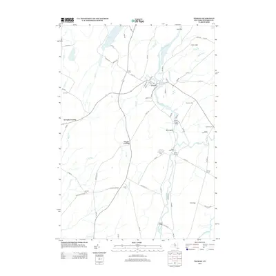
2013 Map of Theresa
USGS Topo · Published 2013About this map
The Indian River winds through the heart of Jefferson County, serving as the central geographic feature for the village of Theresa. This 2013 survey illustrates a landscape defined by its small agricultural hubs and historical intersections, such as Still Corners and Cooper Corners. The rural character of the region is evident in the preservation of several family and community burial grounds, including the Van Allen Cem and Chaufty Cem, which remain as essential touchstones for local genealogical research.
Find a feature on this map
77 named features on this map. Tap any name to fly to it.
Don’t see what you’re looking for? This feature index may not catch every label — zoom into the map to look around manually.
Map Details
Editions of this 2013 Theresa Map
This is the sole edition of this map. No revisions or reprints were ever made.
Other maps of this area

1903 · Alexandria Bay
USGS Topo · 1:62,500

1903 · Theresa
USGS Topo · 1:62,500

1911 · Antwerp
USGS Topo · 1:62,500

1912 · Hammond
USGS Topo · 1:62,500

1943 · Redwood
USGS Topo · 1:31,680

1943 · Lafargeville
USGS Topo · 1:31,680
1943 · Brownville
USGS Topo · 1:31,680

1943 · Alexandria Bay
USGS Topo · 1:31,680

1944 · Hammond
USGS Topo · 1:62,500

1948 · Theresa
USGS Topo · 1:24,000