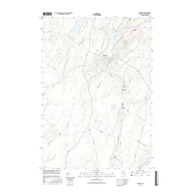
2016 Map of Theresa
USGS Topo · Published 2016About this map
The Indian River winds prominently through this northern New York landscape, anchoring the village of Theresa and the hamlet of Rivergate. This survey highlights the region's complex water system, including the shores of Moon Lake and Hyde Lake, along with the network of creeks like Black Cr and Gillette Cr that drain the undulating terrain. For those tracing local history, several family-named landmarks and burial grounds are documented, such as Kelsey Bridge Cem near the river and the Chaufty Cem situated along the drainage of Black Cr. The map further details a variety of crossings including Coon Bridge and Joachim Bridge, alongside topographical features like Stony Point and Corbin Ledge that define the valley's edges. The road network connects historic settlements via routes like English Settlement RD and Dutch Settlement RD, reflecting the early community patterns of Jefferson County.
Find a feature on this map
63 named features on this map. Tap any name to fly to it.
Don’t see what you’re looking for? This feature index may not catch every label — zoom into the map to look around manually.
Map Details
Editions of this 2016 Theresa Map
This is the sole edition of this map. No revisions or reprints were ever made.
Other maps of this area

1903 · Alexandria Bay
USGS Topo · 1:62,500

1903 · Theresa
USGS Topo · 1:62,500

1911 · Antwerp
USGS Topo · 1:62,500

1912 · Hammond
USGS Topo · 1:62,500

1943 · Redwood
USGS Topo · 1:31,680

1943 · Lafargeville
USGS Topo · 1:31,680
1943 · Brownville
USGS Topo · 1:31,680

1943 · Alexandria Bay
USGS Topo · 1:31,680

1944 · Hammond
USGS Topo · 1:62,500

1948 · Theresa
USGS Topo · 1:24,000