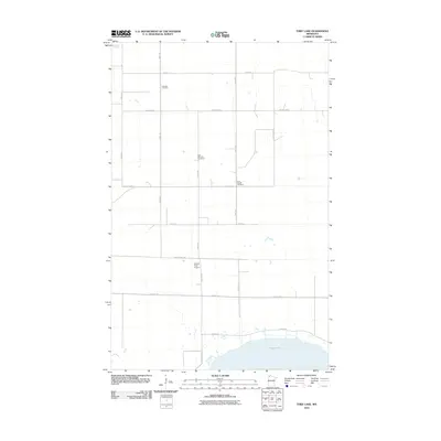
2010 Map of Thief Lake
USGS Topo · Published 2010About this map
Klondike Cemetery and Gust National Cemetery mark the sparse prairie landscape of northern Minnesota in this 2010 topographic record. The area is defined by a rigid grid of rural roads, including 150th St and 300th Ave, which service the isolated farmsteads and open lands of Roseau County. The southern portion of the quadrangle is dominated by the northern reaches of Thief Lake, a significant water body bordered by Refuge Rd, indicating the conservation-focused character of the terrain.
Find a feature on this map
17 named features on this map. Tap any name to fly to it.
Don’t see what you’re looking for? This feature index may not catch every label — zoom into the map to look around manually.
Map Details
Editions of this 2010 Thief Lake Map
This is the sole edition of this map. No revisions or reprints were ever made.
Other maps of this area

1918 · Rollis
USGS Topo · 1:62,500

1918 · Garland
USGS Topo · 1:62,500

1918 · Greenbush
USGS Topo · 1:62,500

1918 · Middle River
USGS Topo · 1:62,500

1943 · Rollis
USGS Topo · 1:62,500

1952 · Thief River Falls
USGS Topo · 1:250,000

1954 · Roseau
USGS Topo · 1:250,000

1956 · Thief River Falls
USGS Topo · 1:250,000

1957 · Roseau
USGS Topo · 1:250,000

1957 · Thief River Falls
USGS Topo · 1:250,000