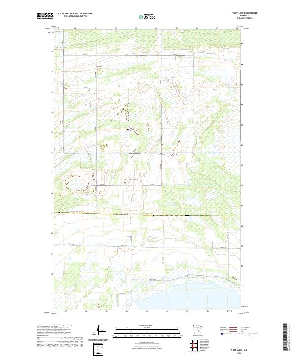
2022 Map of Thief Lake
USGS Topo · Published 2022About this map
Thief Lake dominates the southern reaches of this landscape, its expansive waters and surrounding State Wild Life area defining the border between Roseau and Marshall counties. The terrain is a vast wetland complex, where the natural hydrologic pattern of the region is traced by an orderly grid of section roads like Co Rd 8 and 300th Ave. These corridors provide access to the remote northern timber and marshlands, punctuated only by a few small, significant local landmarks. Genealogists and historians will find interest in the scattered burial grounds that remain as testaments to the early settlement of this challenging landscape, including Klondike Church Cem, Gust National Cem, and Saint Joseph Cem, all situated north of the Co Line Rd Ne boundary.
Find a feature on this map
25 named features on this map. Tap any name to fly to it.
Don’t see what you’re looking for? This feature index may not catch every label — zoom into the map to look around manually.
Map Details
Editions of this 2022 Thief Lake Map
This is the sole edition of this map. No revisions or reprints were ever made.
Other maps of this area

1918 · Rollis
USGS Topo · 1:62,500

1918 · Garland
USGS Topo · 1:62,500

1918 · Greenbush
USGS Topo · 1:62,500

1918 · Middle River
USGS Topo · 1:62,500

1943 · Rollis
USGS Topo · 1:62,500

1952 · Thief River Falls
USGS Topo · 1:250,000

1954 · Roseau
USGS Topo · 1:250,000

1956 · Thief River Falls
USGS Topo · 1:250,000

1957 · Roseau
USGS Topo · 1:250,000

1957 · Thief River Falls
USGS Topo · 1:250,000