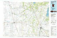
1985 Map of Thief River Falls
USGS Topo · Published 1985About this map
The Thief River Falls hub and the agricultural plains of northwestern Minnesota are documented here in the mid-1980s, revealing an intricate network of water management and transportation. The landscape is dominated by an extensive system of man-made waterways, including Judicial Ditch No 9 and County Ditch No 12, which were engineered to drain the flat, fertile basin of the Red River Valley. These ditches interact with the natural meanders of the Tamarac River, Middle River, and Snake River.
Find a feature on this map
83 named features on this map. Tap any name to fly to it.
Don’t see what you’re looking for? This feature index may not catch every label — zoom into the map to look around manually.
Map Details
Editions of this 1985 Thief River Falls Map
This is the sole edition of this map. No revisions or reprints were ever made.
Other maps of this area

1918 · Rollis
USGS Topo · 1:62,500

1918 · Angus
USGS Topo · 1:62,500

1918 · Terrebonne
USGS Topo · 1:62,500

1918 · Acton
USGS Topo · 1:62,500

1918 · Garland
USGS Topo · 1:62,500

1918 · Red Lake Falls
USGS Topo · 1:62,500

1918 · Argyle
USGS Topo · 1:62,500

1918 · Viking
USGS Topo · 1:62,500

1918 · Greenbush
USGS Topo · 1:62,500

1918 · Warren
USGS Topo · 1:62,500