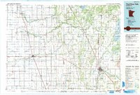
1992 Map of Thief River Falls
USGS Topo · Published 1992About this map
Thief River Falls serves as the regional hub for the Red River Valley’s eastern edge, where the Thief River meets the larger drainage network. This 1992 revision reveals a landscape heavily shaped by civil engineering, dominated by an extensive grid of drainage channels including Judicial Ditch No 9 and County Ditch No 12, which converted the natural wetlands into productive farmland. The area is anchored by the vast Agassiz National Wildlife Refuge and Old Mill State Park, preserving essential prairie and marsh habitats amidst the agricultural expansion.
Find a feature on this map
133 named features on this map. Tap any name to fly to it.
Don’t see what you’re looking for? This feature index may not catch every label — zoom into the map to look around manually.
Map Details
Editions of this 1992 Thief River Falls Map
This is the sole edition of this map. No revisions or reprints were ever made.
Other maps of this area

1918 · Rollis
USGS Topo · 1:62,500

1918 · Angus
USGS Topo · 1:62,500

1918 · Terrebonne
USGS Topo · 1:62,500

1918 · Acton
USGS Topo · 1:62,500

1918 · Garland
USGS Topo · 1:62,500

1918 · Red Lake Falls
USGS Topo · 1:62,500

1918 · Argyle
USGS Topo · 1:62,500

1918 · Viking
USGS Topo · 1:62,500

1918 · Greenbush
USGS Topo · 1:62,500

1918 · Warren
USGS Topo · 1:62,500