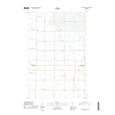
2019 Map of Thief River Falls NE
USGS Topo · Published 2019About this map
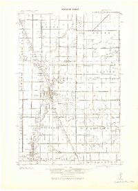
The Thief River winds through the northwestern corner of this landscape, marking a transition between the established agricultural grid and more marshy, undeveloped terrain to the north. This area, spanning the border of Marshall and Pennington Counties, is defined by a dense network of sectional roads and a scattered collection of rural burial grounds. These sites, including Satersdal Cem and Silver Creek Cem, provide tangible links to the early homesteading families who settled the prairie. The map captures a largely rural character where the rectilinear road system, featuring routes like Co Hwy 2 and Co Rd 64, organizes the landscape into a pattern of large agricultural tracts. The southern portion of the sheet shows a higher concentration of family-named landmarks and community hubs like Silverton Cem and Bethlehem Cem, reflecting the enduring settlement patterns of north-central Minnesota.
Find a feature on this map
32 named features on this map. Tap any name to fly to it.
Don’t see what you’re looking for? This feature index may not catch every label — zoom into the map to look around manually.
Map Details
Editions of this 2019 Thief River Falls NE Map
This is the sole edition of this map. No revisions or reprints were ever made.
Other maps of this area
1918 · Rollis
USGS Topo · 1:62,500
1918 · Middle River
USGS Topo · 1:62,500
1943 · Rollis
USGS Topo · 1:62,500
1943 · Thief River Falls
USGS Topo · 1:62,500

1952 · Thief River Falls
USGS Topo · 1:250,000

1954 · Roseau
USGS Topo · 1:250,000

1956 · Thief River Falls
USGS Topo · 1:250,000

1957 · Roseau
USGS Topo · 1:250,000

1957 · Thief River Falls
USGS Topo · 1:250,000

1958 · Roseau
USGS Topo · 1:250,000