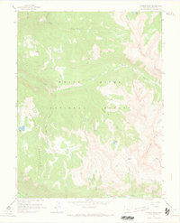
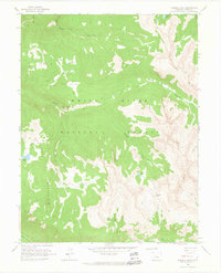
1960 Map of Thimble Rock
USGS Topo · Published 1969About this map
White River National Forest defines this high-altitude landscape in Pitkin County, characterized by a complex network of pack trails and alpine summits. The topography is dominated by the Williams Mts to the east and Smuggler Mountain to the southwest, with the iconic Thimble Rock standing as a central landmark above Hunter Creek. This 1960 field-checked survey documents a wilderness area prior to the intensive development of nearby ski resorts, showing established backcountry routes like the Woody Pack Trail and Hunter Pack Trail. High basins are dotted with named natural features such as Slab Park, Horse Park, and Deer Park, while drainage systems like No Name Creek and Midway Creek flow toward the Roaring Fork River at the southern edge. The map preserves the names of remote water bodies including Warren Lakes and Sawyer Lake, essential points of reference for early mountaineers and forest rangers.
Find a feature on this map
27 named features on this map. Tap any name to fly to it.
Don’t see what you’re looking for? This feature index may not catch every label — zoom into the map to look around manually.
Map Details
Editions of this 1960 Thimble Rock Map
3 editions found
Other maps of this area

1893 · Aspen
USGS Topo · 1:62,500

1895 · Aspen
USGS Topo · 1:62,500

1909 · Mount Jackson
USGS Topo · 1:125,000

1911 · Mount Jackson
USGS Topo · 1:125,000

1957 · Leadville
USGS Topo · 1:250,000

1959 · Leadville
USGS Topo · 1:250,000

1960 · Leadville
USGS Topo · 1:250,000
1960 · Hayden Peak
USGS Topo · 1:24,000
1960 · New York Peak
USGS Topo · 1:24,000
1960 · Thimble Rock
USGS Topo · 1:24,000