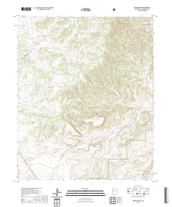
2023 Map of Third Canyon
USGS Topo · Published 2023About this map
Cibola National Forest encompasses the southern reaches of this landscape, where the drainage of Alamocita Creek and White Deer Canyon shape the high desert terrain. The area is defined by its complex network of water management features, including several named tanks like Goat Tank, Freeland Arroyo Tank, and Oat Tank, which support the high-altitude environment. Distinctive geological formations such as Third Canyon Mesa and the deep cuts of Veteado Draw provide a clear view of the natural relief.
Find a feature on this map
29 named features on this map. Tap any name to fly to it.
Don’t see what you’re looking for? This feature index may not catch every label — zoom into the map to look around manually.
Map Details
Editions of this 2023 Third Canyon Map
This is the sole edition of this map. No revisions or reprints were ever made.
Other maps of this area

1917 · Broom Mountain
USGS Topo · 1:125,000

1954 · Saint Johns
USGS Topo · 1:250,000

1954 · Socorro
USGS Topo · 1:250,000

1957 · Saint Johns
USGS Topo · 1:250,000

1958 · Socorro
USGS Topo · 1:250,000

1958 · Saint Johns
USGS Topo · 1:250,000

1962 · Socorro
USGS Topo · 1:250,000

1962 · Saint Johns
USGS Topo · 1:250,000

1963 · Cal Ship Mesa
USGS Topo · 1:24,000

1964 · Third Canyon
USGS Topo · 1:24,000