
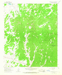
1963 Map of Cal Ship Mesa
USGS Topo · Published 1967About this map
Datil Mountains terrain dominates this high-altitude corner of the Cibola National Forest, where 1960s mapping reveals an intricate network of drainage canyons and livestock infrastructure. Water, the defining resource of the high desert, is meticulously documented through numerous named sources such as Stiver Spring, Skeleton Spring, and Chavez Spring. The map captures a working landscape of ranching and land management, evident in the distribution of stock-watering features like White Mesa Tank, Government Tank, and the Double Tanks Wells.
Find a feature on this map
30 named features on this map. Tap any name to fly to it.
Don’t see what you’re looking for? This feature index may not catch every label — zoom into the map to look around manually.
Map Details
Editions of this 1963 Cal Ship Mesa Map
This is the sole edition of this map. No revisions or reprints were ever made.
Other maps of this area

1954 · Socorro
USGS Topo · 1:250,000

1958 · Socorro
USGS Topo · 1:250,000

1962 · Socorro
USGS Topo · 1:250,000

1963 · Datil
USGS Topo · 1:24,000

1964 · Third Canyon
USGS Topo · 1:24,000

1964 · Dog Springs
USGS Topo · 1:24,000

1964 · Pasture Canyon
USGS Topo · 1:24,000
1964 · Madre Mountain
USGS Topo · 1:24,000

1964 · Crosby Springs
USGS Topo · 1:24,000
1964 · D Cross Mountain
USGS Topo · 1:24,000