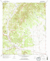
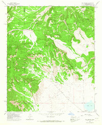
1963 Map of Datil
USGS Topo · Published 1967About this map
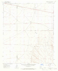
The high-desert terrain of Cibola National Forest dominates this mid-century survey, centered on the small settlement of Datil. Life in this arid corner of New Mexico is defined by its water sources, with numerous named points such as Medley Well, Cold Water Well, and Norman Tank scattered across the landscape to support ranching operations like the Drag A Ranch. The map reveals a rugged topography shaped by the Datil Mountains, featuring prominent landmarks like Indian Peak, the jagged Church Rocks, and the flat-topped Dead Horse Mesa. Historical evidence of habitation is found at the Datil Cem and Jeffers Place, while the presence of a Landing Area and various borrow pits near the highway suggests the mid-century infrastructure supporting this high-altitude community.
Find a feature on this map
41 named features on this map. Tap any name to fly to it.
Don’t see what you’re looking for? This feature index may not catch every label — zoom into the map to look around manually.
Map Details
Editions of this 1963 Datil Map
2 editions found
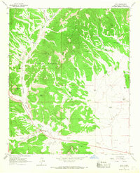
Other maps of this area

1954 · Socorro
USGS Topo · 1:250,000

1958 · Socorro
USGS Topo · 1:250,000

1962 · Socorro
USGS Topo · 1:250,000
1963 · Cal Ship Mesa
USGS Topo · 1:24,000
1963 · Anderson Peak
USGS Topo · 1:24,000
1964 · Dog Springs
USGS Topo · 1:24,000
1964 · Madre Mountain
USGS Topo · 1:24,000
1964 · Crosby Springs
USGS Topo · 1:24,000
1965 · Sugarloaf Mountain
USGS Topo · 1:24,000
1965 · Augustine Well
USGS Topo · 1:24,000