
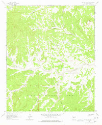
1964 Map of Pasture Canyon
USGS Topo · Published 1967About this map
White House Ranch and the family-named McCord Place sit within a high-elevation landscape defined by the deep incisions of Pasture Canyon and Rock House Canyon. Located in the northern reaches of the Cibola National Forest, this mid-1960s survey records a network of water sources essential for ranching in the high desert. The survival of these outposts depended on a series of wells and windmills, including Buds Windmill, Red Feather Well, and Chamisa Wells, scattered across the terrain.
Find a feature on this map
26 named features on this map. Tap any name to fly to it.
Don’t see what you’re looking for? This feature index may not catch every label — zoom into the map to look around manually.
Map Details
Editions of this 1964 Pasture Canyon Map
2 editions found
Other maps of this area

1917 · Broom Mountain
USGS Topo · 1:125,000

1954 · Socorro
USGS Topo · 1:250,000

1958 · Socorro
USGS Topo · 1:250,000

1962 · Socorro
USGS Topo · 1:250,000

1963 · Cal Ship Mesa
USGS Topo · 1:24,000

1964 · Third Canyon
USGS Topo · 1:24,000

1964 · Wiley Mesa
USGS Topo · 1:24,000

1964 · Dog Springs
USGS Topo · 1:24,000
1964 · Bonine Canyon
USGS Topo · 1:24,000
1964 · Madre Mountain
USGS Topo · 1:24,000