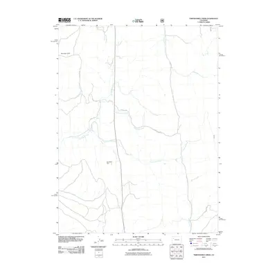
2011 Map of Thirteenmile Creek
USGS Topo · Published 2011About this map
Piceance Creek and its complex network of tributaries define this drainage basin in Garfield County, Colorado. The landscape is characterized by a series of north-south running waterways, including Twelvemile Creek, Thirteenmile Creek, and Fourteenmile Creek, which are segmented by local access routes like 13 Mile Creek Rd and County Rd 13. The mapping reflects a region where water management is critical for local ranching or industry, evidenced by the presence of the West Miller Dam. North of the primary drainages, the terrain rises into Moonlight Gulch and the headwaters of Sheep Creek, showing a pattern of high-altitude valleys. This 2011 survey by the U.S. Geological Survey provides a precise look at the hydrology and backcountry roads used for navigation through these interconnected creeks.
Find a feature on this map
17 named features on this map. Tap any name to fly to it.
Don’t see what you’re looking for? This feature index may not catch every label — zoom into the map to look around manually.
Map Details
Editions of this 2011 Thirteenmile Creek Map
This is the sole edition of this map. No revisions or reprints were ever made.
Other maps of this area

1906 · Grand Hogback
USGS Topo · 1:125,000

1910 · Grand Hogback
USGS Topo · 1:125,000

1925 · Parachute Creek
USGS Topo · 1:62,500

1927 · Parachute Creek
USGS Topo · 1:62,500

1952 · Rio Blanco
USGS Topo · 1:24,000

1952 · Horse Mountain
USGS Topo · 1:24,000

1952 · No Name Ridge
USGS Topo · 1:24,000

1952 · Segar Mountain
USGS Topo · 1:24,000

1956 · Grand Junction
USGS Topo · 1:250,000

1957 · Leadville
USGS Topo · 1:250,000