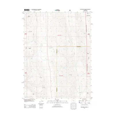
2013 Map of Thirteenmile Creek
USGS Topo · Published 2013About this map
White River National Forest defines the eastern edge of this landscape, where the terrain transitions toward the high summits of the Big Mountain. The topographical prominence of the Grand Hogback serves as a major geological anchor in the south, while the complex drainage network of Thirteenmile Creek, Twelvemile Creek, and Piceance Creek carves a deep sequence of gulches and canyons through the center of the sheet. Named features like Summer Camp Gulch, Turkey Canyon, and Coyote Gulch suggest a long history of seasonal land use and livestock grazing. In addition to these natural landmarks, the map records rural infrastructure such as West Miller Reservoir and a network of remote county routes, including CO Road 84A and CO Road 13, which provide access across Fourteenmile Ridge and into the rugged interior of Garfield and Rio Blanco counties.
Find a feature on this map
35 named features on this map. Tap any name to fly to it.
Don’t see what you’re looking for? This feature index may not catch every label — zoom into the map to look around manually.
Map Details
Editions of this 2013 Thirteenmile Creek Map
This is the sole edition of this map. No revisions or reprints were ever made.
Other maps of this area

1906 · Grand Hogback
USGS Topo · 1:125,000

1910 · Grand Hogback
USGS Topo · 1:125,000

1925 · Parachute Creek
USGS Topo · 1:62,500

1927 · Parachute Creek
USGS Topo · 1:62,500

1952 · Rio Blanco
USGS Topo · 1:24,000

1952 · Horse Mountain
USGS Topo · 1:24,000

1952 · No Name Ridge
USGS Topo · 1:24,000

1952 · Segar Mountain
USGS Topo · 1:24,000

1956 · Grand Junction
USGS Topo · 1:250,000

1957 · Leadville
USGS Topo · 1:250,000