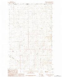
1984 Map of Thoeny Hills West
USGS Topo · Published 1984About this map
The Thoeny Hills anchor this high-plains landscape along the international boundary between Saskatchewan and Phillips County. Mapping efforts by the Geological Survey and the Department of Energy, Mines and Resources Canada emphasize the open, drainage-defined terrain of the northern borderlands during the 1980s. The region is characterized by deep coulees and intermittent water sources, such as the Grag Reservoir and the winding course of Dunham Coulee.
Find a feature on this map
9 named features on this map. Tap any name to fly to it.
Don’t see what you’re looking for? This feature index may not catch every label — zoom into the map to look around manually.
Map Details
Editions of this 1984 Thoeny Hills West Map
This is the sole edition of this map. No revisions or reprints were ever made.
Other maps of this area

1920 · Cowan
USGS Topo · 1:125,000

1954 · Glasgow
USGS Topo · 1:250,000

1957 · Glasgow
USGS Topo · 1:250,000

1958 · Glasgow
USGS Topo · 1:250,000

1984 · Thoeny Hills East
USGS Topo · 1:24,000

1984 · Pea Lake
USGS Topo · 1:24,000

1984 · Whitewater East
USGS Topo · 1:24,000

1984 · Dead Horse Coulee
USGS Topo · 1:24,000
1984 · Salsbery Reservoir
USGS Topo · 1:24,000
2011 · Thoeny Hills West
USGS Topo · 1:24,000