
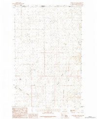
1984 Map of Whitewater East
USGS Topo · Published 1984About this map
Whitewater serves as the primary node of activity in this northern Montana landscape, situated near the western edge of the study area. The terrain is defined by the winding course of the East Fork Whitewater Creek and the sharp relief of Tea Kettle Butte. This 1984 provisional edition highlights the water-scarce nature of the high plains, where isolated features like Lone Tree Spring and named drainage features such as Dunbar Coulee represent vital landmarks for ranching and local navigation. The inclusion of an Airstrip near the settlement underscores the logistical reliance on aviation in these expansive rural stretches of Phillips County.
Find a feature on this map
6 named features on this map. Tap any name to fly to it.
Don’t see what you’re looking for? This feature index may not catch every label — zoom into the map to look around manually.
Map Details
Editions of this 1984 Whitewater East Map
This is the sole edition of this map. No revisions or reprints were ever made.
Other maps of this area

1920 · Cowan
USGS Topo · 1:125,000

1954 · Glasgow
USGS Topo · 1:250,000

1957 · Glasgow
USGS Topo · 1:250,000

1958 · Glasgow
USGS Topo · 1:250,000

1968 · Tattnall
USGS Topo · 1:24,000

1968 · Austin Lake
USGS Topo · 1:24,000

1984 · Pea Lake
USGS Topo · 1:24,000

1984 · Forks
USGS Topo · 1:24,000

1984 · Whitewater West
USGS Topo · 1:24,000
1984 · Thoeny Hills West
USGS Topo · 1:24,000