
1968 Map of Tattnall
USGS Topo · Published 1971About this map
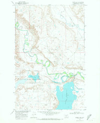
Burlington Northern rails track the winding course of Whitewater Creek in this remote section of Phillips County, Montana. The settlement at Tattnall serves as a small anchor in a landscape defined by an intricate network of drainage channels, including Clark Coulee, Coop Coulee, and Bell Coulee. This 1968 survey was conducted as part of the Department of the Interior program for the development of the Missouri River Basin, reflecting the federal interest in mapping water resources and land use in the high plains. Small-scale water management is evident through features like Austin Dam and Hanson Dam, which likely provided vital stock water for ranching operations. The terrain is marked by numerous springs and intermittent flows, such as Lush Coulee and Gregory Coulee, illustrating the sparse but essential hydrology of north-central Montana.
Find a feature on this map
12 named features on this map. Tap any name to fly to it.
Don’t see what you’re looking for? This feature index may not catch every label — zoom into the map to look around manually.
Map Details
Editions of this 1968 Tattnall Map
This is the sole edition of this map. No revisions or reprints were ever made.
Other maps of this area

1920 · Cowan
USGS Topo · 1:125,000

1954 · Glasgow
USGS Topo · 1:250,000

1957 · Glasgow
USGS Topo · 1:250,000

1958 · Glasgow
USGS Topo · 1:250,000
1968 · Hewitt Lake
USGS Topo · 1:24,000

1968 · Austin Lake
USGS Topo · 1:24,000

1968 · Hewitt Lake SW
USGS Topo · 1:24,000

1984 · Cole
USGS Topo · 1:24,000

1984 · Whitewater East
USGS Topo · 1:24,000

1984 · Forks
USGS Topo · 1:24,000