
1968 Map of Hewitt Lake SW
USGS Topo · Published 1971About this map
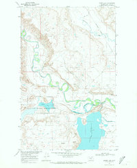
The Milk River defines the northern and western sections of this landscape, its tight meanders carving deep through the Phillips County terrain. The river’s complex path is joined by several drainages, including Little Cottonwood Creek and Martins Coulee, which cut into the surrounding breaks. This 1960s-era topography shows a largely uninhabited landscape primarily dedicated to resource management and conservation. Evidence of subsurface exploration appears in the form of a Drill Hole and Gas Well, scattered across the plateau. The eastern boundary is dominated by the Hewitt Lake National Wildlife Refuge, indicating the importance of these water-scarce lands for habitat protection. Near the southern edge, the Nelson Reservoir and the uniquely named Lone Tree Sag suggest a remote area where water catchment and ephemeral drainages like Canty Coulee dictate the shape of the land.
Find a feature on this map
13 named features on this map. Tap any name to fly to it.
Don’t see what you’re looking for? This feature index may not catch every label — zoom into the map to look around manually.
Map Details
Editions of this 1968 Hewitt Lake SW Map
This is the sole edition of this map. No revisions or reprints were ever made.
Other maps of this area

1905 · Bowdoin
USGS Topo · 1:62,500

1920 · Cowan
USGS Topo · 1:125,000

1954 · Glasgow
USGS Topo · 1:250,000

1957 · Glasgow
USGS Topo · 1:250,000

1958 · Glasgow
USGS Topo · 1:250,000

1968 · Tattnall
USGS Topo · 1:24,000
1968 · Hewitt Lake
USGS Topo · 1:24,000
1968 · Malta NE
USGS Topo · 1:24,000

1968 · Austin Lake
USGS Topo · 1:24,000
1984 · Bowdoin
USGS Topo · 1:24,000