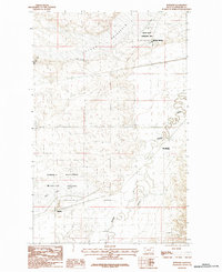
1984 Map of Bowdoin
USGS Topo · Published 1984About this map
Nelson Reservoir dominates the northern reaches of this Phillips County landscape, a central hub for the Nelson State Recreation Area. This 1984 survey illustrates a region defined by sophisticated water management in a semi-arid environment, visible through the course of the Dodson South Canal and the meandering path of Beaver Creek. Small settlements like Sleeping Buffalo and Wooldridge are situated near these water sources, while the southern portion of the sheet transitions into the conservation lands of the Bowdoin National Wildlife Refuge Unit. The presence of Dry Lake and various coulees, such as Thomas Coulee, highlights the natural drainage patterns that have historically shaped ranching and travel in this part of Montana. The settlement of Bowdoin marks a key point of interest for those tracing the development of local transport and infrastructure.
Find a feature on this map
10 named features on this map. Tap any name to fly to it.
Don’t see what you’re looking for? This feature index may not catch every label — zoom into the map to look around manually.
Map Details
Editions of this 1984 Bowdoin Map
2 editions found
Other maps of this area

1905 · Bowdoin
USGS Topo · 1:62,500

1905 · Saco Special
USGS Topo · 1:62,500

1920 · Cowan
USGS Topo · 1:125,000

1954 · Glasgow
USGS Topo · 1:250,000

1957 · Glasgow
USGS Topo · 1:250,000

1958 · Glasgow
USGS Topo · 1:250,000
1968 · Hewitt Lake
USGS Topo · 1:24,000

1968 · Hewitt Lake SW
USGS Topo · 1:24,000

1984 · Clanton Coulee
USGS Topo · 1:24,000

1984 · Cole
USGS Topo · 1:24,000