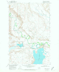
1968 Map of Hewitt Lake
USGS Topo · Published 1971About this map
The Milk River meanders sharply through the northern plains of Montana, creating a complex landscape of oxbows and sloughs that define this 1968 survey. Central to the map is the Hewitt Lake National Wildlife Refuge, a protected sanctuary surrounding Hewitt Lake, which serves as a critical stopover in the Missouri River Basin's hydraulic network. The infrastructure of the era is evident in the sprawling Nelson Reservoir and the carefully engineered Nelson South Canal, highlighting the region's reliance on water management for agriculture and habitat conservation.
Find a feature on this map
27 named features on this map. Tap any name to fly to it.
Don’t see what you’re looking for? This feature index may not catch every label — zoom into the map to look around manually.
Map Details
Editions of this 1968 Hewitt Lake Map
This is the sole edition of this map. No revisions or reprints were ever made.
Other maps of this area

1905 · Bowdoin
USGS Topo · 1:62,500

1905 · Saco Special
USGS Topo · 1:62,500

1920 · Cowan
USGS Topo · 1:125,000

1954 · Glasgow
USGS Topo · 1:250,000

1957 · Glasgow
USGS Topo · 1:250,000

1958 · Glasgow
USGS Topo · 1:250,000

1968 · Tattnall
USGS Topo · 1:24,000

1968 · Austin Lake
USGS Topo · 1:24,000

1968 · Hewitt Lake SW
USGS Topo · 1:24,000

1984 · Cole
USGS Topo · 1:24,000