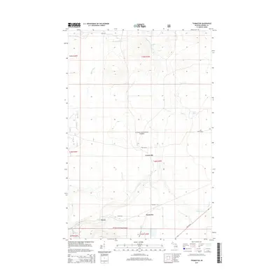
2014 Map of Thomaston
USGS Topo · Published 2014About this map
Thomaston and the small settlements of Connorville and Planter anchor this 2014 survey of the western Upper Peninsula. Situated within the Ottawa National Forest, the landscape is defined by an intricate network of waterways draining toward Lake Superior, including the Black River and numerous named tributaries like Montowibo Cr and Spikehorn Cr. A notable geographic detail is the presence of Root Beer Falls near the southern boundary, a site whose name reflects the unique tea-colored tannin-rich waters common to this region's wilderness. Transportation in this era is represented by the primary corridor of State Hwy 28 and a grid of forest routes such as Forest Rd 648 and Planter Rd, which provide access to the dense timberlands and remote water bodies like Copper Pond.
Find a feature on this map
33 named features on this map. Tap any name to fly to it.
Don’t see what you’re looking for? This feature index may not catch every label — zoom into the map to look around manually.
Map Details
Editions of this 2014 Thomaston Map
This is the sole edition of this map. No revisions or reprints were ever made.
Other maps of this area

1943 · Ironwood
USGS Topo · 1:48,000

1953 · Ashland
USGS Topo · 1:250,000

1955 · Bessemer
USGS Topo · 1:24,000

1955 · Wakefield
USGS Topo · 1:24,000

1955 · Wakefield
USGS Topo · 1:62,500

1955 · Wakefield NE
USGS Topo · 1:24,000

1955 · Ironwood
USGS Topo · 1:62,500

1956 · North Ironwood
USGS Topo · 1:62,500

1956 · Thomaston
USGS Topo · 1:62,500

1958 · Ashland
USGS Topo · 1:250,000