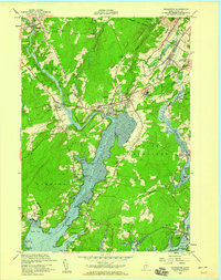
1955 Map of Thomaston
USGS Topo · Published 1959About this map
The St George River dominates this coastal Maine landscape, winding past the maritime and industrial hub of Thomaston. In the mid-1950s, the town's character is defined by the Maine Central Railroad and the notable State Prison Farm located just west of the river's bend. This survey reveals a landscape of transition, where small inland settlements like Wiley Corners and Sharkeyville sit alongside active extraction sites marked as Quarry and Borrow Pit.
Find a feature on this map
69 named features on this map. Tap any name to fly to it.
Don’t see what you’re looking for? This feature index may not catch every label — zoom into the map to look around manually.
Map Details
Editions of this 1955 Thomaston Map
5 editions found

Other maps of this area

1904 · Monhegan
USGS Topo · 1:62,500

1904 · Tenants Harbor
USGS Topo · 1:62,500

1904 · Rockland
USGS Topo · 1:62,500

1906 · Tennant Harbor
USGS Topo · 1:62,500

1906 · Monhegan
USGS Topo · 1:62,500

1906 · Rockland
USGS Topo · 1:62,500

1913 · Waldoboro
USGS Topo · 1:48,000

1915 · Waldoboro
USGS Topo · 1:62,500

1941 · Rockland
USGS Topo · 1:62,500

1941 · Waldoboro
USGS Topo · 1:62,500