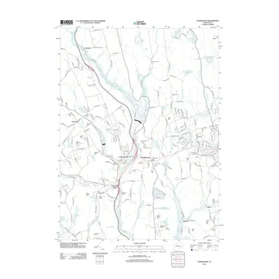
2012 Map of Thomaston
USGS Topo · Published 2012About this map
The Naugatuck River valley anchors this study of the Litchfield Hills region, where industrial heritage and water management define the landscape. The town of Thomaston and neighboring Plymouth serve as the primary population centers, flanked by a complex system of water resources including the Bristol Reservoir Number Four and Plymouth Reservoir. This 2012 topography shows a transition from the dense street grids of the valley floor to the prominent heights of Hickory Hill and Mount Tobe. Local history is preserved in several burial grounds, such as Hillside Cem and Saint Marys Cem, while the southern reaches of the map reflect the area's recreational character through Camp Mattatuck and the Waterbury Airport. The convergence of Pequabuck River and local brooks illustrates the historical reliance on water power that shaped these Connecticut mill towns.
Find a feature on this map
230 named features on this map. Tap any name to fly to it.
Don’t see what you’re looking for? This feature index may not catch every label — zoom into the map to look around manually.
Map Details
Editions of this 2012 Thomaston Map
This is the sole edition of this map. No revisions or reprints were ever made.
Other maps of this area

1892 · Winsted
USGS Topo · 1:62,500

1892 · Meriden
USGS Topo · 1:62,500

1892 · Granby
USGS Topo · 1:62,500

1893 · Waterbury
USGS Topo · 1:62,500

1893 · Meriden
USGS Topo · 1:62,500

1904 · Waterbury
USGS Topo · 1:62,500

1904 · Litchfield
USGS Topo · 1:125,000

1906 · Farmington
USGS Topo · 1:125,000
1946 · Southington
USGS Topo · 1:31,680

1946 · Bristol
USGS Topo · 1:31,680