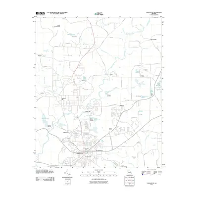
2011 Map of Thomaston
USGS Topo · Published 2011About this map
Thomaston and its surrounding mill communities dominate this central Georgia landscape, reflecting a long history of textile manufacturing and local industry. The map details the transition from the city center to the industrial residential areas of Silvertown and East Thomaston, while smaller outlying settlements like Hannahs Mill and Paynes Mill appear along the banks of Potato Creek. To the west, Indian Grave Mountain rises as a distinct landmark above the rolling terrain of Upson County. This 2011 record is particularly valuable for genealogists, as it documents numerous local burial sites including Glenwood Cemetery, Crystal Hill Cemetery, and Antioch Cemetery. The geography is defined by a dense network of water bodies and small reservoirs, such as Pasley Lake and Lake Maude, providing a clear picture of the region's managed waterways and agricultural infrastructure during the early 21st century.
Find a feature on this map
106 named features on this map. Tap any name to fly to it.
Don’t see what you’re looking for? This feature index may not catch every label — zoom into the map to look around manually.
Map Details
Editions of this 2011 Thomaston Map
This is the sole edition of this map. No revisions or reprints were ever made.
Other maps of this area

1935 · Thomaston
USGS Topo · 1:48,000

1939 · Thomaston
USGS Topo · 1:62,500

1951 · Yatesville
USGS Topo · 1:62,500

1951 · Barnesville
USGS Topo · 1:62,500

1953 · Atlanta
USGS Topo · 1:250,000

1955 · Phenix City
USGS Topo · 1:250,000

1957 · Phenix City
USGS Topo · 1:250,000

1957 · Atlanta
USGS Topo · 1:250,000

1958 · Phenix City
USGS Topo · 1:250,000

1958 · Atlanta
USGS Topo · 1:250,000