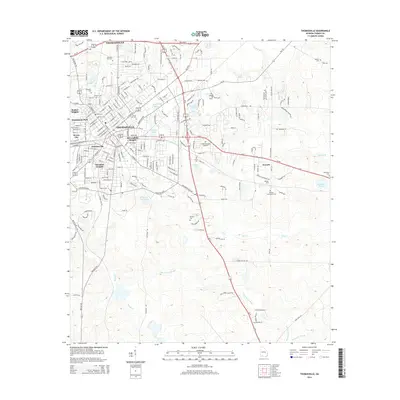
2014 Map of Thomasville
USGS Topo · Published 2014About this map
Thomasville serves as the hub of this South Georgia landscape, where a dense concentration of neighborhood districts and long-established cemeteries reflects a deep communal history. Established sectors like Fletcherville, Booker Heights, and Dewey City radiate from the core, while Thomas University anchors the southern portion of the city. The landscape is notably defined by its numerous final resting places, ranging from the central Laurel Hill Cem and Magnolia Cem to the outlying Benton Cem and Vann Cem.
Find a feature on this map
204 named features on this map. Tap any name to fly to it.
Don’t see what you’re looking for? This feature index may not catch every label — zoom into the map to look around manually.
Map Details
Editions of this 2014 Thomasville Map
This is the sole edition of this map. No revisions or reprints were ever made.
Other maps of this area

1954 · Valdosta
USGS Topo · 1:250,000

1954 · Tallahassee
USGS Topo · 1:250,000

1956 · Monticello NE
USGS Topo · 1:24,000

1956 · Cairo
USGS Topo · 1:62,500

1956 · Metcalf
USGS Topo · 1:24,000

1957 · Miccosukee NE
USGS Topo · 1:24,000

1957 · Thomasville
USGS Topo · 1:62,500

1958 · Valdosta
USGS Topo · 1:250,000

1959 · Tallahassee
USGS Topo · 1:250,000

1959 · Valdosta
USGS Topo · 1:250,000
Featured Places
- Thomasville, GA
- Theodore Heights, Thomasville
- Newark, GA
- Fletcherville, Thomasville
- McLoughlin Heights, Thomasville