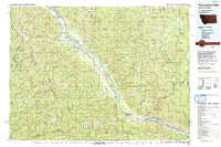
1992 Map of Thompson Falls
USGS Topo · Published 1993About this map
Thompson Falls serves as the focal point of this western Montana landscape, situated where the Clark Fork widens into the Thompson Falls Reservoir. The map reveals a region deeply defined by its water and timber resources, with the massive Noxon Reservoir stretching northwest toward the settlements of Trout Creek and Noxon. The surrounding terrain is dominated by high peaks of the Cabinet Mountains Wilderness and the Coeur d'Alene Mountains, indicating a history of isolated mountain extraction and forestry.
Find a feature on this map
66 named features on this map. Tap any name to fly to it.
Don’t see what you’re looking for? This feature index may not catch every label — zoom into the map to look around manually.
Map Details
Editions of this 1992 Thompson Falls Map
This is the sole edition of this map. No revisions or reprints were ever made.
Other maps of this area

1901 · Coeur D'Alene District
USGS Topo · 1:62,500

1903 · Coeur D'Alene District
USGS Topo · 1:62,500

1906 · Coeur D'Alene District
USGS Topo · 1:62,500

1909 · Cataldo
USGS Topo · 1:125,000

1911 · Cataldo
USGS Topo · 1:125,000

1911 · Priest Lake
USGS Topo · 1:250,000

1913 · Priest Lake
USGS Topo · 1:250,000

1914 · Avery
USGS Topo · 1:125,000

1917 · Avery
USGS Topo · 1:125,000

1918 · St Regis
USGS Topo · 1:125,000