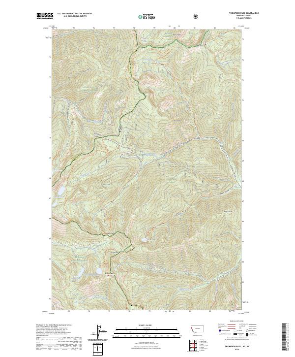
2024 Map of Thompson Pass
USGS Topo · Published 2024About this map
Thompson Pass and Glidden Pass serve as primary crossings along the high divide of the Coeur d'Alene Mountains, marking the boundary between Shoshone and Sanders counties. This alpine terrain is defined by a network of glacial cirque lakes, including Revett Lake, Pear Lake, and the connected waters of Lower Glidden Lake and Upper Glidden Lake. The landscape is managed across three major forest jurisdictions: the Kaniksu, Lolo, and Coeur d'Alene National Forests. Transportation through the area follows established corridors like Prospect Creek Rd and Bear Creek Rd, while the Thompson Pass-Revett Lk Trl provides interior access. Noteworthy peaks and ridges such as Beaver Peak, Andys Knob, and Glidden Ridge punctuate the skyline, with water systems such as Prospect Creek and the Little North Fork South Fork Coeur d'Alene River draining the steep slopes toward the valleys below.
Find a feature on this map
49 named features on this map. Tap any name to fly to it.
Don’t see what you’re looking for? This feature index may not catch every label — zoom into the map to look around manually.
Map Details
Editions of this 2024 Thompson Pass Map
This is the sole edition of this map. No revisions or reprints were ever made.
Other maps of this area

1901 · Coeur D'Alene District
USGS Topo · 1:62,500

1903 · Coeur D'Alene District
USGS Topo · 1:62,500

1906 · Coeur D'Alene District
USGS Topo · 1:62,500

1914 · Avery
USGS Topo · 1:125,000

1917 · Avery
USGS Topo · 1:125,000

1932 · Trout Creek
USGS Topo · 1:125,000

1935 · Trout Creek
USGS Topo · 1:125,000

1936 · Trout Creek
USGS Topo · 1:125,000

1956 · Cooper Gulch
USGS Topo · 1:62,500

1956 · Saltese
USGS Topo · 1:62,500