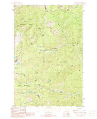
1988 Map of Thompson Pass
USGS Topo · Published 1988About this map
Thompson Pass marks the high point of the Bitterroot Range crossing on this 1980s-era topographic survey, which documents the rugged border between the Shoshone and Sanders counties. The landscape is defined by its intense alpine topography and mining heritage, evidenced by numerous Prospect and Prospects scattered across the Coeur d'Alene, Kaniksu, and Lolo national forests. This area serves as a critical watershed, where the headwaters of the Little North Fork South Fork Coeur d'Alene River begin their journey west into Idaho. Distinctive high-altitude basins hold Revett Lake, Blossom Lakes, and the paired Upper Glidden Lake and Lower Glidden Lake, providing a clear look at the glacial geography along the Idaho-Montana state line before modern development altered these remote access points.
Find a feature on this map
43 named features on this map. Tap any name to fly to it.
Don’t see what you’re looking for? This feature index may not catch every label — zoom into the map to look around manually.
Map Details
Editions of this 1988 Thompson Pass Map
This is the sole edition of this map. No revisions or reprints were ever made.
Other maps of this area

1901 · Coeur D'Alene District
USGS Topo · 1:62,500

1903 · Coeur D'Alene District
USGS Topo · 1:62,500

1906 · Coeur D'Alene District
USGS Topo · 1:62,500

1914 · Avery
USGS Topo · 1:125,000

1917 · Avery
USGS Topo · 1:125,000

1932 · Trout Creek
USGS Topo · 1:125,000

1935 · Trout Creek
USGS Topo · 1:125,000

1936 · Trout Creek
USGS Topo · 1:125,000

1956 · Cooper Gulch
USGS Topo · 1:62,500

1956 · Saltese
USGS Topo · 1:62,500