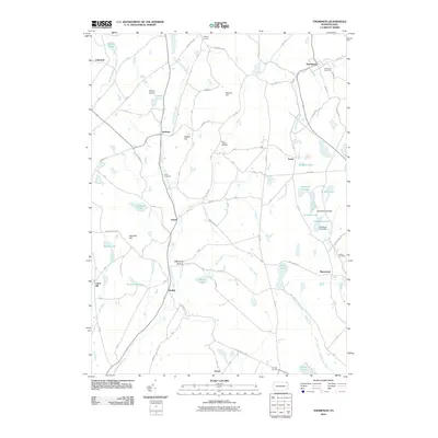
2010 Map of Thompson
USGS Topo · Published 2010About this map
Thompson stands as a primary settlement in this Susquehanna County landscape, where the headwaters of Starrucca Creek and the West Branch Lackawanna River begin their respective journeys. The area is characterized by a high concentration of small, named water bodies such as Fiddle Lake, Ball Lake, and Stearns Lake, which are interspersed with family-named elevations like Snake Hill and Slocum Hill. For genealogists, the map is particularly rich, identifying several burial grounds including Fairmount Cemetery and Lamb Cemetery, alongside small crossroads communities like Gelatt, Smiley, and Ararat. The local infrastructure is shaped by historic routes like the Great Bend Tpke and Old Newburg Tpke, tracing the movement of people and goods through the hills. This 2010 survey reflects a rural corridor where legacy agriculture and newer additions like the Aldrich Airport coexist among the winding creeks and hollows.
Find a feature on this map
61 named features on this map. Tap any name to fly to it.
Don’t see what you’re looking for? This feature index may not catch every label — zoom into the map to look around manually.
Map Details
Editions of this 2010 Thompson Map
This is the sole edition of this map. No revisions or reprints were ever made.
Other maps of this area

1892 · Honesdale
USGS Topo · 1:62,500

1892 · Dundaff
USGS Topo · 1:62,500

1924 · Starrucca
USGS Topo · 1:48,000

1926 · Starrucca
USGS Topo · 1:62,500

1930 · Starrucca
USGS Topo · 1:48,000

1932 · Susquehanna
USGS Topo · 1:62,500

1933 · Starrucca
USGS Topo · 1:62,500

1935 · Susquehanna
USGS Topo · 1:62,500

1943 · Honesdale
USGS Topo · 1:125,000

1946 · Forest City
USGS Topo · 1:24,000