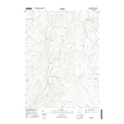
2016 Map of Thompson
USGS Topo · Published 2016About this map
Thompson and Jackson anchor this region of Susquehanna County, where the landscape is defined by the high divides between the Tunkhannock Cr and the Starrucca Cr drainage. Small settlements like Gelatt, Ararat, and Smiley are linked by a network of historic routes including the Great Bend Tpke and the Old Newburgh Tpke. For those tracing local history, the map identifies numerous family and community landmarks, such as Fairmount Cem and the East Jackson Cem. The topography is punctuated by prominent rises like Slocum Hill and Snake Hill, while the eastern portion of the quadrangle is characterized by a high concentration of glacial features, including Fiddle Lake, Hathaway Lake, and several marshy areas like Sinkhole Swamp. This detailed survey documents the persistent rural character and the enduring patterns of transit that have shaped these Pennsylvania townships.
Find a feature on this map
80 named features on this map. Tap any name to fly to it.
Don’t see what you’re looking for? This feature index may not catch every label — zoom into the map to look around manually.
Map Details
Editions of this 2016 Thompson Map
This is the sole edition of this map. No revisions or reprints were ever made.
Other maps of this area

1892 · Honesdale
USGS Topo · 1:62,500

1892 · Dundaff
USGS Topo · 1:62,500

1924 · Starrucca
USGS Topo · 1:48,000

1926 · Starrucca
USGS Topo · 1:62,500

1930 · Starrucca
USGS Topo · 1:48,000

1932 · Susquehanna
USGS Topo · 1:62,500

1933 · Starrucca
USGS Topo · 1:62,500

1935 · Susquehanna
USGS Topo · 1:62,500

1943 · Honesdale
USGS Topo · 1:125,000

1946 · Forest City
USGS Topo · 1:24,000