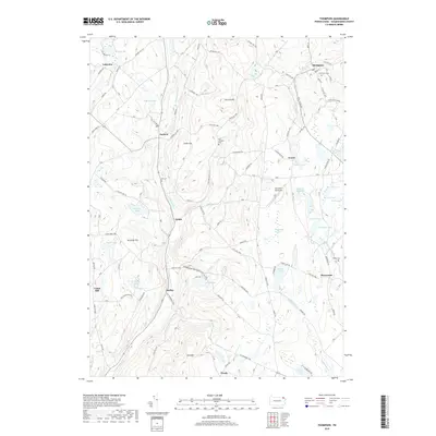
2019 Map of Thompson
USGS Topo · Published 2019About this map
Thompson and the surrounding townships of Susquehanna County are defined by a high-elevation landscape of glacial ponds and narrow valleys. This late-2010s survey details the headwaters of major regional waterways, including the Tunkhannock Cr and the W Br Lackawanna River, which carve through the plateau near East Mtn. Small settlements like Ararat, Jackson, and Gelatt serve as local nodes within a network of historic roads, such as the Old Newburg Tpke. The map provides specific locations for genealogical research, including Fairmount Cem, Lamb Cem, and Foster Cem. Aviation is represented by the Mountain Top Airport, while the area's natural hydrology is documented through features like Fiddle Lake, Hathaway Lake, and the extensive Tinglepaugh Swamp.
Find a feature on this map
98 named features on this map. Tap any name to fly to it.
Don’t see what you’re looking for? This feature index may not catch every label — zoom into the map to look around manually.
Map Details
Editions of this 2019 Thompson Map
This is the sole edition of this map. No revisions or reprints were ever made.
Other maps of this area

1892 · Honesdale
USGS Topo · 1:62,500

1892 · Dundaff
USGS Topo · 1:62,500

1924 · Starrucca
USGS Topo · 1:48,000

1926 · Starrucca
USGS Topo · 1:62,500

1930 · Starrucca
USGS Topo · 1:48,000

1932 · Susquehanna
USGS Topo · 1:62,500

1933 · Starrucca
USGS Topo · 1:62,500

1935 · Susquehanna
USGS Topo · 1:62,500

1943 · Honesdale
USGS Topo · 1:125,000

1946 · Forest City
USGS Topo · 1:24,000