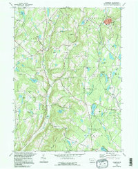
1994 Map of Thompson
USGS Topo · Published 1995About this map
Tunkhannock Creek carves a deep path through the highlands of Susquehanna County, anchoring a landscape where agricultural settlements like Gelatt and Jackson are defined by the surrounding ridges. The terrain is marked by prominent elevations including East Mountain and Slocum Hill, while the historical path of the Newburgh Turnpike cuts across the southern portion of the quadrangle near Dimock Corners. This region is a watershed divide, with the headwaters of the West Branch Lackawanna River and Starrucca Creek flowing from numerous glacial ponds and wetlands like Sinkhole Swamp.
Find a feature on this map
52 named features on this map. Tap any name to fly to it.
Don’t see what you’re looking for? This feature index may not catch every label — zoom into the map to look around manually.
Map Details
Editions of this 1994 Thompson Map
This is the sole edition of this map. No revisions or reprints were ever made.
Other maps of this area

1892 · Honesdale
USGS Topo · 1:62,500

1892 · Dundaff
USGS Topo · 1:62,500

1924 · Starrucca
USGS Topo · 1:48,000

1926 · Starrucca
USGS Topo · 1:62,500

1930 · Starrucca
USGS Topo · 1:48,000

1932 · Susquehanna
USGS Topo · 1:62,500

1933 · Starrucca
USGS Topo · 1:62,500

1935 · Susquehanna
USGS Topo · 1:62,500

1943 · Honesdale
USGS Topo · 1:125,000

1946 · Forest City
USGS Topo · 1:24,000