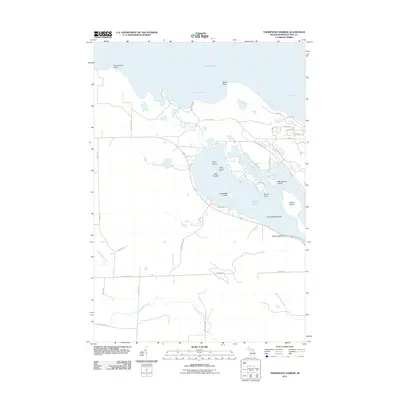
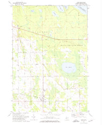
2011 Map of Thompsons Harbor
USGS Topo · Published 2011About this map
Lake Huron and the northern reaches of Grand Lake define this coastal section of Presque Isle County. The shoreline is characterized by prominent landmarks like Observatory Point and Black Point, which frame the sheltered waters of Thompsons Harbor and North Bay. Inward from the coast, a complex network of islands sits within the larger lake basin, including Grand Island, Macombers Island, and the Three Sisters Island. The drainage of the land is visible through several waterways such as Schalks Creek and Monaghan Creek, which wind toward the coast. Local transit is facilitated by a grid of rural routes like N Grand Lake Hwy and Old State Rd, serving the residential developments around Black Bass Bay and the wooded interior toward Warren Creek.
Find a feature on this map
50 named features on this map. Tap any name to fly to it.
Don’t see what you’re looking for? This feature index may not catch every label — zoom into the map to look around manually.
Map Details
Editions of this 2011 Thompsons Harbor Map
This is the sole edition of this map. No revisions or reprints were ever made.
Other maps of this area

1954 · Alpena
USGS Topo · 1:250,000

1957 · Alpena
USGS Topo · 1:250,000

1958 · Alpena
USGS Topo · 1:250,000

1969 · Alpena
USGS Topo · 1:250,000
1971 · Presque Isle
USGS Topo · 1:24,000

1971 · Long Lake West
USGS Topo · 1:24,000
1971 · Adams Point
USGS Topo · 1:24,000

1971 · Polaski
USGS Topo · 1:24,000
1971 · Thompsons Harbor
USGS Topo · 1:24,000
1971 · Posen
USGS Topo · 1:24,000