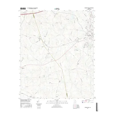
2017 Map of Thomson West
USGS Topo · Published 2017About this map
Mesena sits at the heart of this landscape, located along the western reaches of the Thomson area. The survey reveals a region defined by extensive family and community burial grounds, illustrating a deep-rooted genealogical heritage. Significant sites like the David Neal Senior Cem, Joseph McMath Cem, and Stone Chapel Cem are scattered across the terrain, often adjacent to early congregations such as the Society Cem and New Hope Cem. The waterway of Brier Cr winds through the southern half of the quadrangle, serving as a primary drainage for the surrounding hills. To the east, the outskirts of Thomson show more concentrated development near the Thomson City Cem and Springfield Cem, while the western portion remains characterized by rural routes like Rock House Rd and the small settlement of Plainview.
Find a feature on this map
108 named features on this map. Tap any name to fly to it.
Don’t see what you’re looking for? This feature index may not catch every label — zoom into the map to look around manually.
Map Details
Editions of this 2017 Thomson West Map
This is the sole edition of this map. No revisions or reprints were ever made.
Other maps of this area

1892 · Mc Cormick
USGS Topo · 1:125,000

1906 · Crawfordville
USGS Topo · 1:125,000

1912 · Mc Cormick
USGS Topo · 1:125,000

1921 · Appling
USGS Topo · 1:62,500

1922 · Harlem
USGS Topo · 1:62,500

1943 · Appling
USGS Topo · 1:62,500

1948 · Harlem
USGS Topo · 1:62,500

1948 · Thomson East
USGS Topo · 1:24,000

1950 · Dearing
USGS Topo · 1:24,000
1950 · Bowdens Pond
USGS Topo · 1:24,000